


What Is a Tropical Cyclone? Hurricane, Tropical Storm & Tropics Explained (2026)
Everything you need to know — from how storms form over warm ocean water to tracking hurricanes in real time, understanding watches and warnings, and what’s happening right now in the Gulf.
Every June, millions of people along coastlines from Texas to Florida start watching the tropics with a mixture of fascination and dread. Search volumes spike for terms like tropical storm, hurricane tracker, tropical storm watch, and tropical storm in gulf — and in 2026, that season has arrived early. As of today, a disturbance in the Gulf is threatening to become Tropical Storm Arthur, the first named storm of the 2026 Atlantic season, with a Tropical Storm Watch in effect for parts of Texas and Louisiana.
Whether you live near the coast, you’re visiting Houston for the FIFA World Cup, or you’re just curious about what meteorologists actually mean when they say tropical cyclone, this guide breaks it all down — clearly, completely, and with the latest data from NOAA and the National Hurricane Center.
What Is a Tropical Cyclone?
A tropical cyclone is the scientific term for all rotating storm systems that form over warm tropical ocean waters. The name changes depending on where in the world the storm develops, but the physics are identical everywhere on Earth.
According to Britannica, a tropical cyclone originates over warm tropical oceans and is defined by low atmospheric pressure, heavy rainfall, and winds exceeding 119 km/h (74 mph) once it reaches full hurricane strength. The same storm carries different regional labels:
| Region | Name Used |
|---|---|
| North Atlantic & eastern North Pacific | Hurricane |
| Western North Pacific | Typhoon |
| South Pacific & Indian Ocean | Cyclone or Severe Tropical Cyclone |
| Scientific / universal term | Tropical Cyclone |
Whatever they are called — hurricane, typhoon, or cyclone — the underlying formation process, structure, and destructive potential are the same. When people search for what is a tropical cyclone, the simplest answer is: it is the global term for what Americans call a hurricane.
How Does a Tropical Cyclone Form? The Science
Tropical cyclones act like giant heat engines. NASA’s precipitation education portal describes them as engines that use warm, moist air as fuel — which is why they can only form over warm ocean water near the equator. Here is how the process unfolds step by step.
The Four Ingredients of a Tropical Cyclone
According to meteorologists at Descartes Underwriting and backed by NOAA research, four core atmospheric conditions must align for a tropical cyclone to develop:
| Ingredient | Why It Matters |
|---|---|
| 🌊 Warm sea-surface water (above 26°C / 80°F) | Provides the heat energy that powers the storm; the warm top 50 meters of ocean are the fuel tank |
| 💧 Moist, rising air | Water vapor rises, cools, and condenses, releasing latent heat that keeps the engine running |
| 🌬 Low vertical wind shear | Allows the storm to organize vertically without being torn apart by opposing winds at different altitudes |
| 🌍 Coriolis effect from Earth’s rotation | Gives the storm its characteristic spin — counterclockwise in the Northern Hemisphere, clockwise in the Southern |
NOAA’s NESDIS explains that when warm, moist air rises from the ocean surface, it leaves behind a low-pressure zone. Surrounding higher-pressure air rushes in to fill that gap, gets warmed and moistened in turn, and then rises too — creating a continuous, self-reinforcing cycle. As the storm organizes, Earth’s rotation imparts a spin that tightens into the classic spiral structure visible from satellites.
The Four Stages: From Disturbance to Hurricane
NOAA meteorologists divide tropical cyclone development into four official stages based on the storm’s wind speed and organization. Understanding these stages is essential to interpreting any hurricane tracker or NHC advisory.
A storm earns the label tropical storm the moment its sustained winds hit 39 mph — and that is also the moment it receives a name from the World Meteorological Organization’s official list. Once winds reach 74 mph, the storm is classified as a hurricane in the Atlantic or eastern Pacific.
Tropical Storm Arthur 2026: What’s Happening Right Now in the Gulf
The NHC is giving this disturbance a 60% chance of developing into a tropical depression or tropical storm over the next 48 hours. Here is what forecasters are tracking:
| Factor | Current Forecast |
|---|---|
| System name | Potential Tropical Cyclone One → expected to become Tropical Storm Arthur |
| Current location | Near Texas–Mexico border / northwestern Gulf of America |
| Development odds | 60% within 48 hours (NHC) |
| Expected rainfall | 4–8 inches widespread; isolated totals up to 12 inches |
| Storm surge | 2–4 feet possible along upper Texas and Louisiana coast |
| Primary threat | Life-threatening flash flooding across southern Texas, including Houston |
| Tropical Storm Watch area | Sargent, TX eastward to Morgan City, LA |
| Expected landfall | Near Texas/Louisiana border, late Wednesday into Thursday |
The heavy rain is already affecting Houston, where FIFA World Cup 2026 events are taking place. The FIFA Fan Festival Houston delayed its opening due to the storm threat. Forecasters stress that regardless of whether the system officially becomes Tropical Storm Arthur, the flooding threat is real and significant for Southeast Texas and Louisiana.
Tropical Storm Watch vs. Hurricane Watch: What Do They Mean?
One of the most searched topics during storm season is the difference between a watch and a warning. The distinction is critical for knowing when to act.
| Alert Type | What It Means | Timeframe | Action |
|---|---|---|---|
| 🟡 Tropical Storm Watch | Tropical storm conditions (39–73 mph winds) are possible | Within 48 hours | Monitor conditions; begin preparations |
| 🟠 Tropical Storm Warning | Tropical storm conditions are expected | Within 36 hours | Preparations must be complete; be ready to shelter |
| 🔴 Hurricane Watch | Hurricane conditions (74+ mph winds) are possible | Within 36 hours | Finalize preparations; know your evacuation zone |
| 🔴🔴 Hurricane Warning | Hurricane conditions are expected | Within 24 hours | All preparations complete; evacuate if ordered |
| ⚡ Storm Surge Warning | Life-threatening coastal flooding expected | Imminent | Evacuate surge zones immediately |
Hurricane Categories: The Saffir-Simpson Wind Scale Explained
Once a tropical storm intensifies into a hurricane, meteorologists classify it using the Saffir-Simpson Hurricane Wind Scale (SSHWS) — a 1-to-5 rating system developed in 1971 by engineer Herbert Saffir and meteorologist Robert Simpson. The scale is based solely on maximum sustained wind speed and estimates potential property damage.
| Category | Wind Speed | Damage Level | Expected Impact |
|---|---|---|---|
| Cat 1 | 74–95 mph | Minimal | Large tree branches down, some siding/shingles blown off, power outages |
| Cat 2 | 96–110 mph | Moderate | Roof, window, and siding damage; numerous downed trees; near-total power loss |
| Cat 3 ⭐ Major | 111–130 mph | Extensive | Significant coastal flooding, major property damage, power outages for weeks |
| Cat 4 ⭐ Major | 131–155 mph | Extreme | Coastal homes flood with several feet of water; widespread roof damage; outages lasting over a month |
| Cat 5 ⭐ Major | 157+ mph | Catastrophic | Most coastal homes underwater; roofs blown off; areas uninhabitable for weeks |
Categories 3, 4, and 5 are classified as major hurricanes due to their catastrophic potential for both property damage and loss of life. It is important to note that the scale measures only wind speed — storm surge, rainfall flooding, and tornadoes are separate threats that can be deadly even in lower-category storms.
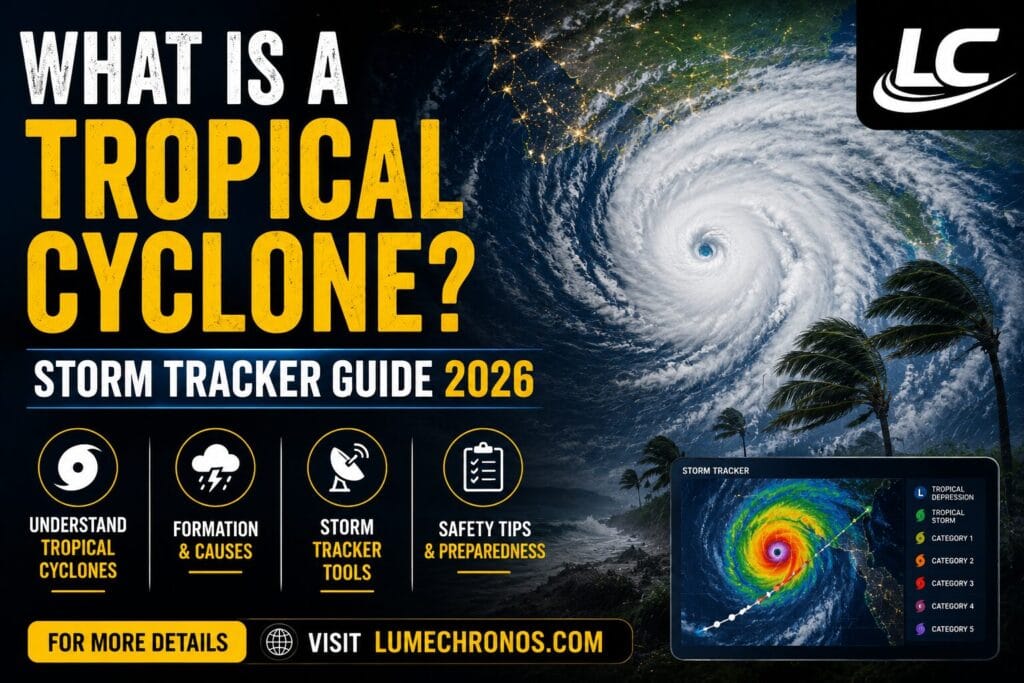
How to Track Tropical Storms and Hurricanes in Real Time
With a potential storm brewing in the Gulf right now, knowing how to use a reliable hurricane tracker is essential. Here are the best tools for monitoring the tropics:
Official Government Sources
| Tool | Best For | Website |
|---|---|---|
| NHC Tropical Weather Outlook | Official track forecasts, cone graphics, advisories | nhc.noaa.gov |
| NOAA Weather | Satellite imagery, watches & warnings maps | weather.gov |
| GOES-East Satellite | Real-time satellite views of the Atlantic & Gulf | nesdis.noaa.gov |
| Weather.gov Local Office | Local forecasts, flood alerts, inland impacts | weather.gov |
Third-Party Tracking Apps
Apps such as Weather Underground, Weather.com Hurricane Center, and MyRadar offer consumer-friendly real-time tracking with push notifications for watches and warnings. For ensemble model tracks and advanced meteorological data, apps like PolarWX.com and Spire Weather provide multi-model comparison tools used by professional forecasters.
What the Cone of Uncertainty Means
The NHC’s famous “cone” graphic shows the probable path of a storm’s center over the next five days. A critical point: the cone represents the likely track of the center only — not the size of the storm. Hurricane-force winds, storm surge, and heavy rain can extend far beyond the cone’s edges. Never assume you are safe just because you fall outside the cone.
The 2026 Atlantic Hurricane Season Outlook
NOAA’s official 2026 Atlantic hurricane season forecast calls for a below-normal season, primarily because El Niño conditions are expected to develop and intensify throughout the summer and fall. El Niño typically suppresses Atlantic tropical activity by increasing upper-level wind shear — the very factor that prevents storms from organizing.
However, NOAA also notes that Atlantic Ocean temperatures are expected to be slightly warmer than normal and trade winds are likely to be weaker than average — factors that can counteract El Niño’s suppression. The agency cautions that even in below-normal seasons, a single major hurricane making landfall can be catastrophic.
| 2026 Season Forecast Element | NOAA Outlook |
|---|---|
| Overall season activity | Below-normal |
| Primary suppressing factor | El Niño development |
| Competing factor | Warmer-than-normal Atlantic SSTs |
| Storm names — first three | Arthur, Bertha, Cristobal |
| Season dates | June 1 – November 30, 2026 |
| NHC improvement | Advisory products now issued up to 72 hours before storm surge or tropical-storm-force winds arrive on land |
Tropical Cyclones vs. Other Storm Types: Key Differences
| Storm Type | Heat Source | Wind Pattern | Season | Region |
|---|---|---|---|---|
| Tropical Cyclone (Hurricane) | Warm ocean water (thermally driven) | Warm core, winds increase toward center | Summer–Fall | Tropics & subtropics |
| Extratropical Cyclone (nor’easter) | Temperature contrast between air masses | Cold core, wider wind field | Year-round | Mid-latitudes |
| Tornado | Atmospheric instability (supercell) | Narrow rotating column, can accompany hurricanes | Spring–Summer | Continental interiors |
| Tropical Depression | Warm ocean (pre-hurricane stage) | Closed circulation, winds < 39 mph | Summer–Fall | Tropics |
Storm Surge: The Deadliest Threat You May Not Be Thinking About
While wind speed dominates headlines, storm surge is responsible for the majority of hurricane-related fatalities. Storm surge is an abnormal rise in sea water level pushed ashore by a storm’s winds and low pressure — and it can reach 20 feet or more in a major hurricane.
The Saffir-Simpson Scale does not measure storm surge. A Category 2 hurricane with a particular track and coastal geometry can generate surge that rivals a Category 4 storm in some locations. During Hurricane Ike in 2008, for example, a Category 2 storm at landfall generated storm surge typical of a Category 4 or 5 hurricane along the Texas coast, contributing to 112 deaths — many from people who decided not to evacuate after seeing the lower category number.
Key Takeaways
What You Need to Know About Tropical Cyclones
- A tropical cyclone is the universal scientific term for hurricanes, typhoons, and cyclones — the name changes by region, the storm does not.
- Tropical cyclones form only over warm ocean water (above 26°C / 80°F) and require warm seas, rising moist air, low wind shear, and Earth’s Coriolis effect.
- A tropical storm has sustained winds of 39–73 mph; a hurricane has sustained winds of 74 mph or more and is rated Category 1–5 on the Saffir-Simpson Scale.
- A Tropical Storm Watch means conditions are possible in 48 hours — begin preparations. A Warning means they are expected in 36 hours — act immediately.
- Tropical Storm Arthur may be the first named storm of 2026, threatening the Gulf Coast near Texas and Louisiana with flood rains and storm surge this week.
- NOAA forecasts a below-normal 2026 Atlantic hurricane season due to El Niño, but any season can produce a destructive storm — preparation is always essential.
- Storm surge, not wind, is the leading cause of hurricane fatalities. Do not use the category number alone to judge your risk.
Frequently Asked Questions
🌊 Stay Ahead of Storm Season
Bookmark LumeChronos.com for ongoing coverage of tropical weather, hurricane trackers, and storm preparedness guides throughout the 2026 Atlantic hurricane season.
Visit LumeChronos.com →Explore more in-depth analysis of global defense, economics, and investment trends at lumechronos.com | Shop our premium content resources at lumechronos.shop | For German-language readers, visit our platform at lumechronos.de


